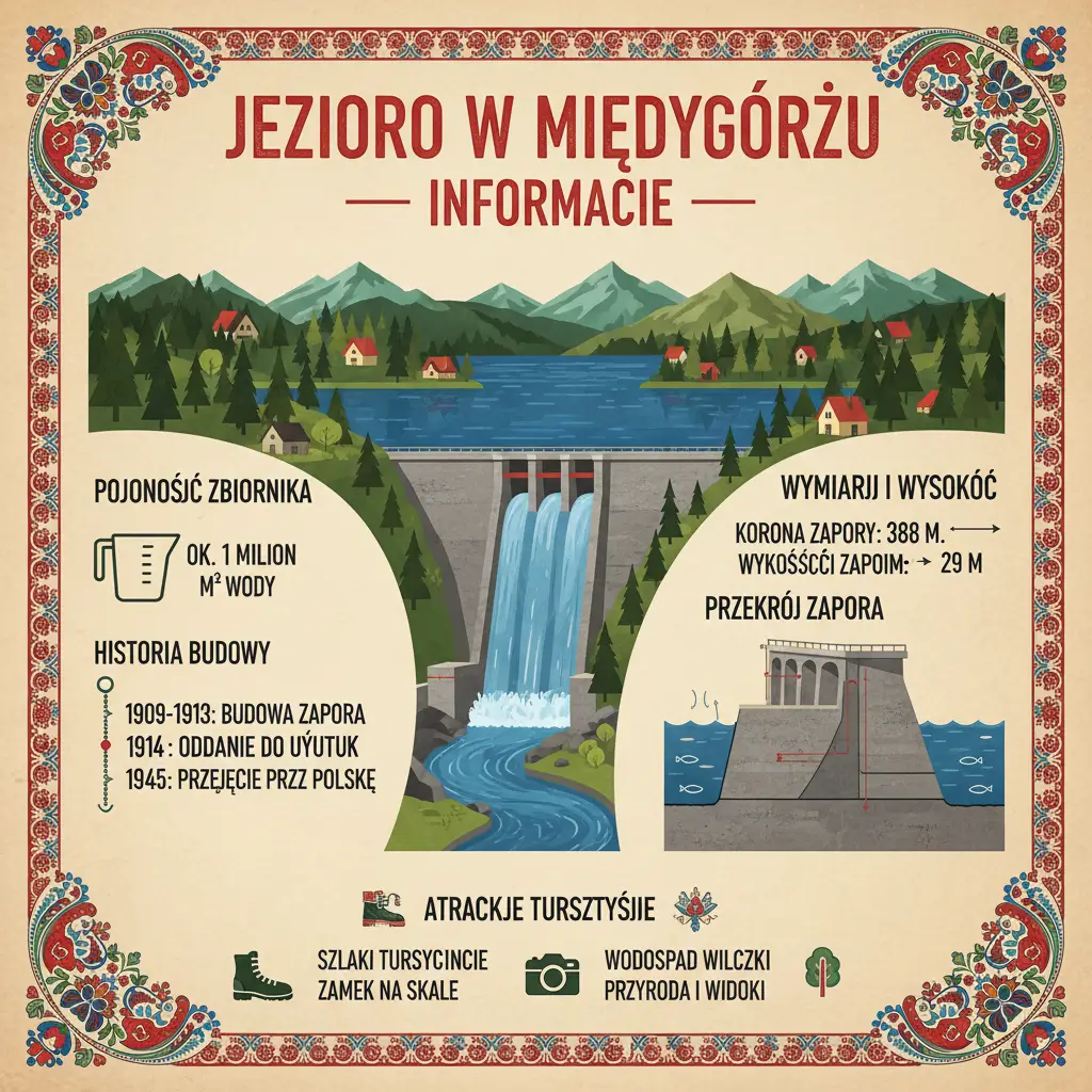
The Lake in Międzygórze is one of the least known but most striking artificial water reservoirs in the Sudetes – a flood control dam that was created under the influence of tragedy and transformed into an inspiring tourist attraction. Although formally “The Dam in Międzygórze” or “The Międzygórze Reservoir”, for the residents of the Kłodzko Valley it is simply The Lake – a symbol of engineering triumph from the beginning of the 20th century, which today serves both to protect against floods and for the recreation of tourists seeking peace among the mountains. This 29-meter-high masonry dam with a length of 110 meters, which crosses the Wilczka stream, creates a dry retention reservoir with a capacity of 830,000 cubic meters, just 800 meters below the famous Wilczki Waterfall – and offers both historical engineering lessons and amazing views of the Jeseníky Mountains and the Śnieżnik Massif. The history of the creation of this reservoir is a story about human helplessness in the face of nature, the ambition of engineers, and ultimately – about the victory of the human spirit.
History – From Tragedy to Technological Triumph
1897 – The Great Oder Flood and the Impetus for Action
The history of the Lake in Międzygórze begins with tragedy. In 1897, the Oder flooded significant areas of Lower Silesia, destroying villages, ruining crops, and devastating the economies of entire families.
The flood was surprisingly rapid – the water appeared quickly, without warning, and swept away everything in its path.
The lesson: Systemic flood protection is needed – not only emergency services, but retention and water infrastructure that will store water during times of flooding.
1901 – Construction Permit and Plan Development
After the tragedy of 1897, the government of the German Empire (Silesia was then part of Germany) decided to act.
On November 6, 1901, a formal permit was granted to build a reservoir on the Wilczka stream in Międzygórze.
German engineers developed a plan:
Dry reservoir – this means that most of the time the reservoir would be empty or filled to the level of the bottom culvert.
Masonry dam made of 100,000 tons of stone – this was a huge structure for those times.
Capacity: 830,000 cubic meters – it could stop a significant part of the flood wave.
1905–1909 Years – Dam Construction
The construction of the dam began in 1905.
For four years, German and Polish workers (let’s say “Polish”, because Silesia was multi-ethnic) worked in mountainous conditions – in snow in winter and in heat in summer.
Construction technique (revolutionary for its time):
Gluing stone with lime and sand – instead of cement (which was still expensive)
Manual digging and transporting of materials – there were no loaders
Building temporary transport roads to the construction site
On April 1, 1909, the dam was officially completed.
The opening ceremony was a great event – Prussian authorities, engineers from all over Europe, and local dignitaries attended.
1909–1945 German Period – Testing and Optimization
The dam worked reliably for 36 years before World War II.
When there were increases in the water level – especially during spring thaws – the reservoir retained some of this water, and the bottom culverts released it slowly, safely for the residents below.
1950s – Energy Plans, Abandoned Dreams
In the 1950s, after World War II, the new Polish authorities and engineers considered **transforming the reservoir into a permanently filled one and using it for energy purposes.
The dream was beautiful – a hydroelectric power plant whose turbines would power nearby villages with electricity.
However, the reality was brutal:
Small reservoir capacity – 830,000 cubic meters is large, but not large enough for a profitable power plant
Catchment area with a purely mountainous character – there were no permanent water sources in dry seasons
The costs of transformation would be enormous – the dam would have to be rebuilt
The plans were abandoned. The reservoir remained what German engineers had planned it to be – a retention reservoir.
Technical Parameters of the Dam – Numbers Speak Volumes
Physical Dimensions
Main Dam:
- <p class="my-2
Height: 29 meters
Length: 110 meters
Width: 7.5 meters at the base
Construction Type: Masonry – built of stone blocks
Location: On the Wilczka stream, 9.85 kilometers from its source, in Międzygórze, Lower Silesian Voivodeship
Water reservoir
Total capacity: 830 thousand m³ = 830 million liters of water
Reservoir Surface Area: 0.07 km² = 7 hectares
Catchment area (the area from which water flows into the reservoir): 25 km²
Culverts and Outlets
Bottom culvert (lower):
Dimensions: 0.8 × 1.0 meters
Function: Transferring water in normal times
Outlet Depth: Approximately 6 meters below the normal reservoir level
Middle culvert:
Dimensions: 1.1 × 1.5 meters
Depth: Approximately 13 meters above the bottom culverts
Function: Discharging additional water during floods
Surface Overflow (upper):
Length: 45.55 meters
Crest Height: 523.95 meters above sea level
Maximum Capacity: 37.5 m³/s at maximum impoundment
Geographical Location
Altitude: The dam is located at approximately 800–900 meters above sea level
Distance from Wilczki Waterfall: Just 800 meters below the famous waterfall
Distance from the Center of Międzygórze: Approximately 1–1.5 kilometers
Bathing Area and Tourist Infrastructure
Is Swimming Allowed?
This is a controversial question. Formally, the reservoir is a retention reservoir – a dry flood control reservoir, not a bathing area. However:
In Practice:
During dry seasons, the reservoir is almost never completely full – it has a layer of water on the bottom at a depth of several meters
During the time of spring thaws or heavy rainfall, the reservoir rises
Informally, tourists and residents sometimes swim in it, especially on hot summer days
Safety:
The reservoir has a steep shoreline – there is no flat beach
The water can be very cold – it comes from mountain streams
There are no official lifeguards – swimming is at your own risk
<p class="my-2 [&+p]:mt-4 [&_strong:has(+br)]:inline-block
Verdict: This is a considerable bathing area, but it is not officially marked as a bathing area. If you want to officially bathe, it is better to go to the swimming pool in Międzylesie (nearby town) or to other bathing areas in the region.
Infrastructure
At the Dam:
Walking path – you can walk along the front wall of the dam, offering spectacular views
Viewpoints – several places allowing for a camera
Missing: public toilets, buffet, deckchairs
Nearby:
Restaurants and cafes – in the center of Międzygórze, about 1.5 kilometers
Holiday homes and guesthouses – about 30 accommodation facilities
Riding school – for those who like horses
Flood Protection Function – How Does the Reservoir Save Lower Areas?
Mechanism of Operation
The Międzygórze dam works on the principle of water retention (storage):
During Normal Times: The reservoir is empty – water from the Wilczki stream flows through the bottom culverts directly down
During Rainfall: When a large amount of rain falls, the Wilczki stream swells. Instead of all the water flowing immediately (which would cause a rapid rise downstream), the dam retains some of this water in the reservoir
Slow Discharge: The dam slowly releases water through the culverts, reducing the peak of the flood wave – instead of a sudden jump in water, we have a gradual increase
Effectiveness – Modern Tests
Flood in June 2020:
During the flood, the reservoir reached a level of 1284 cm (excluding the central culvert), without reachingover the spillway – this shows that the dam effectively stopped the flood wave, and the infrastructure below was safe.
Flood in September 2024:
During the drastic flood in September 2024, water began to flow over the surface spillway on September 14th. Although it was dramatic, the spillway worked exactly as planned – dissipating the water safely instead of allowing a sudden flood.
Historical and Contemporary Facts
The “Dry” Reservoir Name
The name “dry reservoir” seems strange – but it means that the reservoir is not a visible lake most of the time. It is rather just an empty basin, ready to receive water in the event of a flood. In the dry seasons, tourists seeing the reservoir may be disappointed – there is no beautiful lake there, only a riverbed.
Wilczki Stream – Not an Ordinary Stream
The Wilczki Stream is a right tributary of the Nysa Kłodzka River. It is not a small, dried-up channel – it is a strong mountain stream that has enormous power during thaws and rainfall.
Debris Dam – Secret Protection
Above the main dam, in the Wilczki riverbed, a second (smaller) dam was built – a debris dam.
Its task is to stop sediments and boulders that the Wilczki stream carries from the mountains. Without this dam, the main dam would be fed with sand and rubble, which would reduce its capacity and shorten its lifespan.
Who Should Visit the Lake in Międzygórze?
Ideally Suited To:
Engineering history enthusiasts – the dam is an engineering masterpiece from 1909
Photographers – the views of the reservoir and surrounding mountains are spectacular
Educational tourists – interesting lessons about water resource protection
Families with Children – a walk along the dam wall is safe and fascinating
Pilgrims – on the way to the Wilczki Waterfall or to the Sanctuary on Mount Igliczna
NOT Suited To:
Extreme Adventure Seekers – the lake is calm, not extreme
Technical Divers – the reservoir is not suitable for divers
Practical Information
How to Get There?
From the Center of Międzygórze: 1–1.5 kilometers on foot or by car
Road: Clearly marked with a green tourist trail
Walking Time: 20–30 minutes from the city center
Parking
Parking at the Dam: Yes, there are parking spaces
Parking in Międzygórze: Several car parks in the center
Equipment
What to Bring: Camera, good shoes, bottle of water
If You Plan to Swim: Swimsuit, towel, change of clothes
Safety
There are no lifeguards – swimming at your own risk
The water is cold – originating from mountain springs
The bottoms are rocky – you have to watch out for your feet